After 20 years of preparation – S-100 is now becoming a reality
News 2026-09-18
After nearly two decades of international development work and preparation, the Swedish Maritime Administration is now taking a major step toward the next generation of digital maritime information. The first Swedish nautical chart products based on the new S-100 standard are now beginning to be distributed.
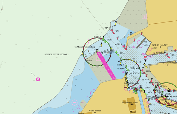
Shipping is entering a period of technological transition. For many years, the Swedish Maritime Administration, together with other maritime nations and international organisations, has been working to develop and prepare for the introduction of S-100 – the new international standard for digital maritime information. That work is now beginning to deliver tangible results.
The Swedish Maritime Administration is now starting to deliver S-101, the new generation of electronic navigational charts, to its distribution channel PRIMAR. The rollout will take place gradually, with the goal of making all of Sweden available in the new format by the end of the year.
“It feels almost incredible that this is now becoming a reality. The fact that the first products are now leaving the Swedish Maritime Administration is an important milestone. It is the result of many years of work, ranging from international standardisation and specifications to production, technology, systems development and quality assurance,” says Magnus Wallhagen, Head of International Affairs within the Hydrographic Services business area.
More than a new nautical chart
S-101 is the successor to today’s electronic navigational charts based on the S-57 standard. However, the transition to S-100 involves much more than simply changing the chart format.
The major change becomes clear when several different types of information can be used together. Alongside the rollout of S-101, the Swedish Maritime Administration will therefore also make S-102 available for certain areas. S-102 contains detailed depth information and is one of several new products that can be combined within S-100.
In the longer term, this will create entirely new possibilities for presenting and using information such as nautical charts, depth data, water levels, currents and navigational warnings together and in a more dynamic way. For navigators on board ships, this development means that information previously found in separate systems and products can increasingly be brought together and used within the same navigation environment.
The implementation is co-funded by the European Union through the Interreg Baltic Sea Region programmes.
S-100 is an international framework for digital maritime information developed by the International Hydrographic Organization (IHO). The standard makes it possible to combine several different types of quality-assured information in ships’ navigation systems.
Some examples of products within the S-100 family include:
S-101 – next-generation electronic navigational charts
S-102 – detailed depth information
S-104 – water level information
S-111 – surface current information
S-124 – navigational warnings