
Tried-and-tested technology ensures safe maritime navigation during GPS disruptions
News 2025-12-19
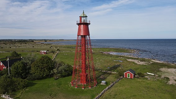
GPS disruptions in the Baltic Sea are increasing the need for alternative navigation systems. The Swedish Maritime Administration will now equip ten lighthouse sites in southern Sweden with technology that responds to radar signals, with the aim of improving maritime safety.
The installation of the so-called Racons will take place over the coming months, starting at Kapelludden on the island of Öland. The term Racon – a combination of “radar” and “beacon” – describes exactly what they are: radar beacons. A transponder that responds with Morse code when it receives a radar signal from a passing vessel. This provides an effective way to determine a vessel’s position even when GPS signals cannot be relied upon.
“The technology is far from new, as the Swedish Maritime Administration has long operated around 90 Racons. However, as GPS disruptions have become more frequent, the need for alternative navigation systems has increased,” says Johan Winell, Head of Business Area at the Swedish Maritime Administration. “What is new is installing them on tall coastal lighthouses in vulnerable areas to provide an additional means of navigation in poor visibility.”
The Swedish Maritime Administration has already installed the first Racon at Kapelludden Lighthouse on Öland. The aim is to install Racons at ten existing lighthouse sites in southern Sweden, where the coastline is often low-lying and difficult to distinguish.
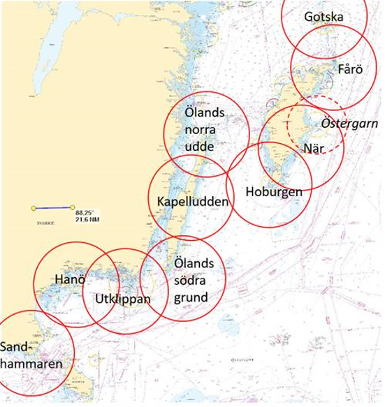
The Swedish Maritime Administration has already installed the first Racon at Kapelludden Lighthouse on Öland. The aim is to install Racons at ten existing lighthouse sites in southern Sweden, where the coastline is often low-lying and difficult to distinguish.
“Along many stretches of our coastline, it can be difficult to determine your position using radar. This is because the coast may be flat and lack distinctive features, such as headlands, that provide clear reference points on the radar display,” says Johan Winell.
The installation of new Racons is not the only measure the Swedish Maritime Administration has taken in response to GPS disruptions in the Baltic Sea. For several years, the agency has been participating in an EU project alongside several other Baltic Sea countries to develop alternative navigation systems, as previously reported by the Swedish Maritime Administration. These systems are expected to be in place by 2027.
FACTS:
The Swedish Maritime Administration plans to install Racons at ten locations along Sweden’s southern and eastern coasts, as well as on the islands of Öland and Gotland. The locations are: Sandhammaren, Hanö, Utklippan, Ölands södra grund, Kapelludden, Ölands norra udde, Hoburgen, När, Fårö and Gotska Sandön.