New Reference Level in Charts and Products
The Swedish Maritime Administration aims to, in databases and products containing geographical information use the geodetic reference system in plan and elevation supported by the Swedish National Land Survey. In 2005 a new national height system was introduced, RH 2000 (Swedish National Height System 2000).

The Swedish Maritime Administration aims to, in databases and products containing geographical information use the geodetic reference system in plan and elevation supported by the Swedish National Land Survey. In 2005 a new national height system was introduced, RH 2000 (Swedish National Height System 2000). It provides significantly better accuracy than older systems and is designed for modern satellite-based measurement operations and navigation. It is also built on international recommendations, creating better opportunities for coordination with other countries.
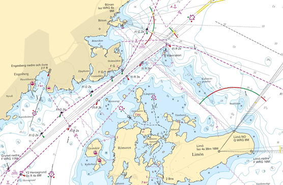
The Swedish Maritime Administration has begun the process of adapting their databases and products accordingly. The depth database was converted in 2013. For the chart database, which serves as the source for all chart products, this is a much more comprehensive undertaking. This transition will therefore be gradual and the aim is that it will be completed by the end of 2030. A new chart, 5342 Gävle (produced in 2014), along with its related larger scale plans and ENC cells, are the first chart products to have RH 2000 as the chart datum.
A Common Reference Level
With the introduction of RH 2000, all charts and products will refer to a common chart datum. The traditional way of referencing depth information in Swedish charts has been to specify a mean sea level for a given year (typically the chart production year). This has led to that there are a variety of reference levels used throughout the entire product portfolio, even in adjacent and overlapping products.
It will also become easier to correct chart depths against current depth, as one no longer needs to take into account the land-uplift in the same way as before, but primarily correct for the current sea level.
Lakes and canals have a specific chart datum, but they already have, or will have, a definition of their level relative to the zero level in the RH 2000. For example, the lake of Mälaren has a chart datum that is +0.78 m RH 2000.
International and National
Currently, there is an international agreement among the member states of Baltic Sea Hydrographic Commission (BSHC) to implement one common reference level for nautical charts and sea level information within the Baltic Sea region. The common reference level is called the Baltic Sea Chart Datum 2000 (BSCD2000). RH 2000 is a valid implementation and application of this in Sweden.
RH 2000 is the official national height system in Sweden, which is now in use in both public and private sectors in Sweden. Information about heights on land refers to this system and stepwise the depths in nautical charts will refer to the same system. Since June 2019, all sea level information, such as observations, forecasts and warnings, refers to this system. To use the same system for heights on land, depths in nautical charts and for sea level information eases the work in projects and activities which includes both land and water, for example infrastructure projects, wind power at sea, flood simulation, landslide risk analysis etc.
For further information, see the adjacent links.
Last updated 2021-06-16